
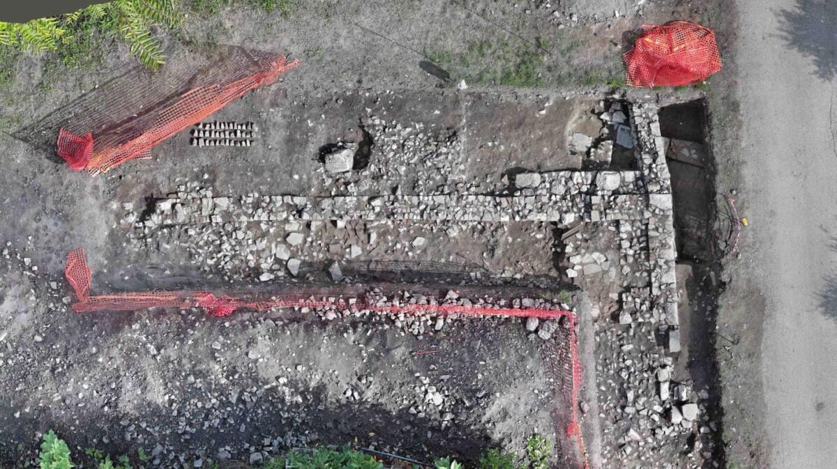
During the recently concluded excavation campaign led by Giuseppe Ceraudo and Veronica Ferrari from the Department of Cultural Heritage in the locality of Piano di Sant’Arcangelo (in Campania, southern Italy), three trenches were opened along the path of the modern trail, which lies over the remains and represents the survival of the ancient Via Traiana, promoted by Emperor Trajan in 109 AD as an alternative route to the Via Appia from Benevento to Brindisi.
The investigations, carried out with the concession of the Superintendence of Archaeology, Fine Arts, and Landscape for the provinces of Caserta and Benevento, are linked to the recognition of the Via Appia Claudia and the Traiana as a World Heritage Site. The World Heritage Committee, meeting in New Delhi at its 46th session on July 27, ratified the inscription of the Via Appia. Queen of Roads on the World Heritage List. The site is the 60th Italian heritage site recognized by UNESCO.
The activity was conducted as part of one of the interventions of the Borghi project, the result of collaboration between the municipalities of Paduli and Sant’Arcangelo Trimonte, with the “focal point” being the site of Forum Novum/Contrada Sant’Arcangelo, aiming to create the first nucleus of a “linear archaeological park” along the Via Traiana.
The mayor of Paduli, Dr. Domenico Vessichelli, explained: It is a serial site, consisting of a series of components identified along the Via Appia Claudia—the route initiated in 312 BC by Censor Appius Claudius the Blind to connect Rome with Capua, later extended to Benevento, Venosa, Taranto, and Brindisi, the gateway to Greece and the East as Roman conquests advanced—and along the Via Appia Traiana, the variant promoted and carried out by Emperor Trajan in 109 AD to facilitate a quicker route from Benevento to the port of Brindisi.
The excavation and research intervention was carried out specifically to enhance one of the 19 sections that have been recognized by UNESCO: the one crossing the municipal territories of Benevento, Paduli, Sant’Arcangelo Trimonte, and Buonalbergo.
This is the first scientific intervention of archaeological excavation carried out on the Via Traiana after the significant recognition, done in close collaboration between the Municipality of Paduli, the Superintendence of Archaeology, Fine Arts, and Landscape for the Provinces of Caserta and Benevento, and the University of Salento.
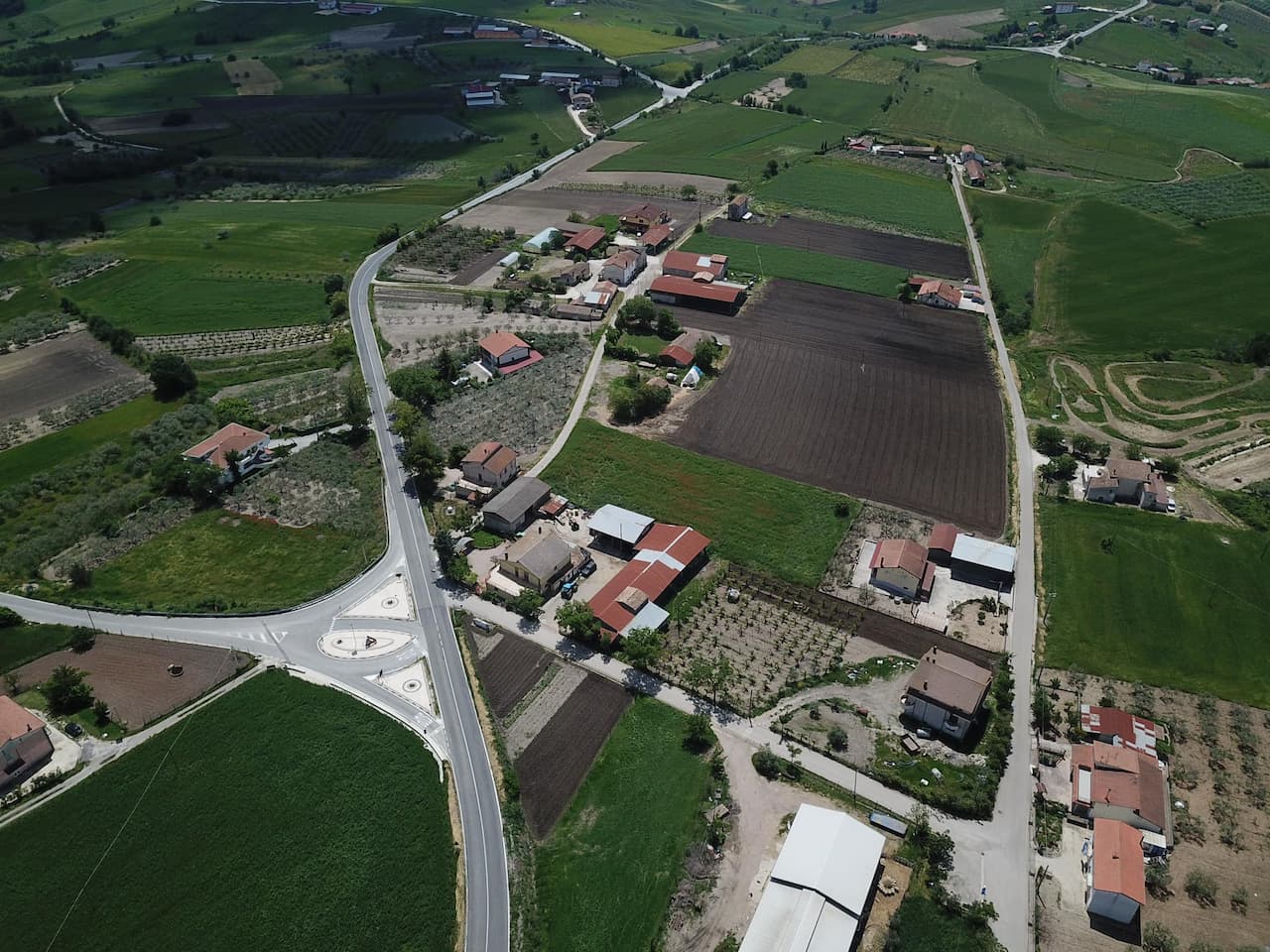
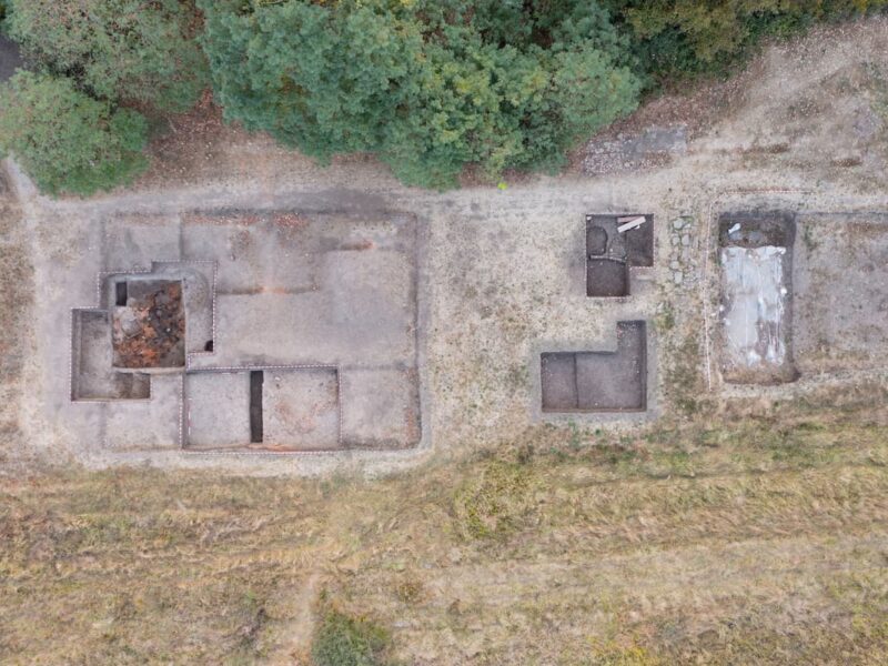
These new interventions are the direct result of a constant and intense topographical reconnaissance activity in the territory, accompanied by aerial surveys using drones equipped with different sensors (optical, thermal, multispectral, Lidar), along with geophysical survey campaigns, explains Professor Giuseppe Ceraudo. The activities we conduct on the ground are characterized by a non-invasive, effective, and very sophisticated research methodology aimed at identifying buried assets of our Heritage. Here in Forum Novum, the surveys revealed anomalies related to numerous buried structures.
The anomalies identified through the surveys were later subjected to archaeological excavation, allowing for their precise verification. Everything discovered in this first excavation campaign represents a crucial step in the reconstruction and definition of the layout of the vicus (neighborhood) of Forum Novum, which was the first rest station along the Via Traiana, 10 miles (about 15 km) from the caput viae of Beneventum, a kind of large service area along what we can consider a real highway of the Roman era.
The excavations, which involved numerous students, mostly from the University of Salento but also from other Italian and foreign universities, allowed for the first scientific exposure of the stratified remains of the settlement. These cover a very broad chronological range, from the late Republican period to the late Imperial age.
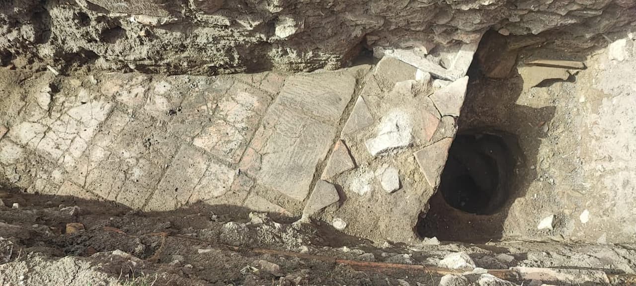
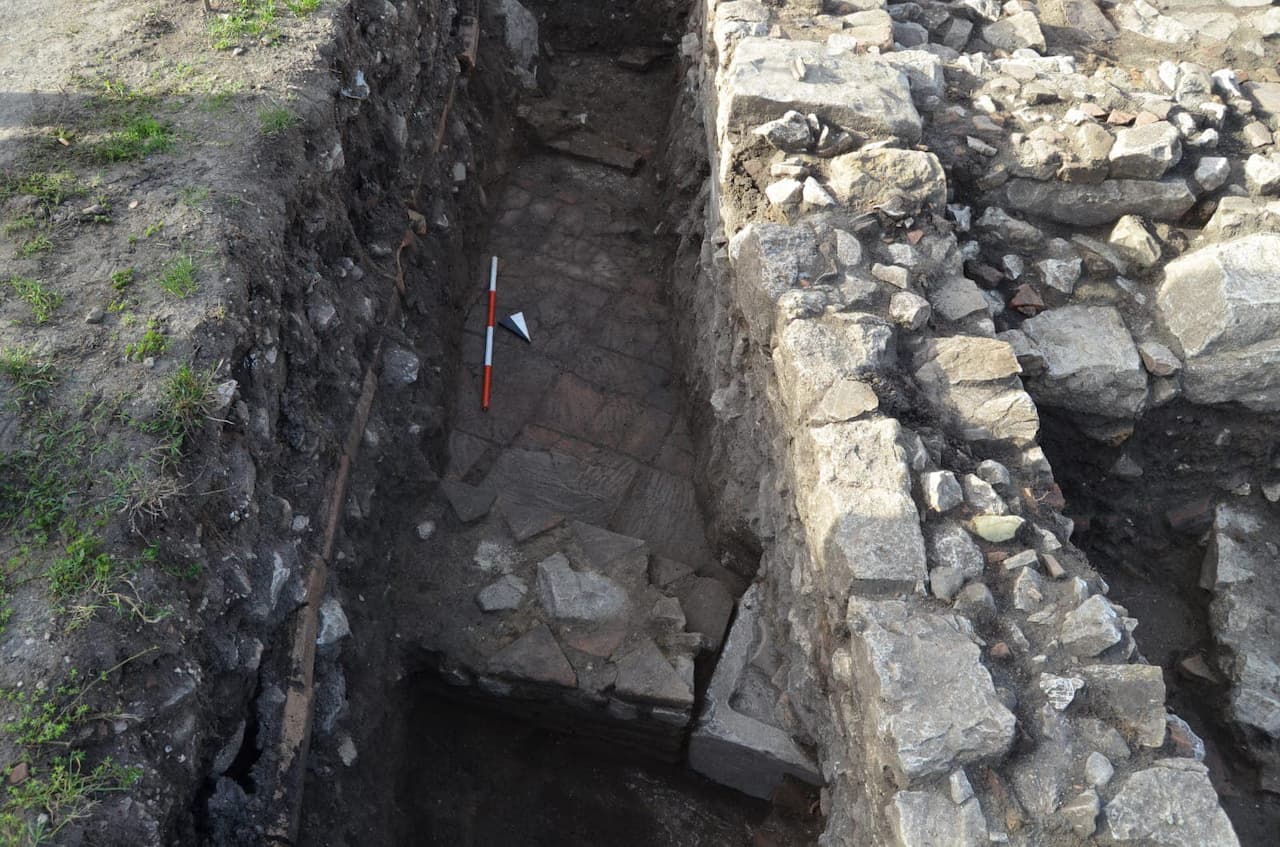
The discovery of the remains of a large structure whose function is still unclear has surprised the entire work team. It appears to date back to the late Middle Ages, reusing many stones from the original pavement of the Via Traiana in its walls.
The imposing structure, only partially revealed in trench 2, may be connected to a cemetery area identified about ten meters to the west in trench 1. A very suggestive but still unconfirmed hypothesis is that these remains may be linked to the cult of the Archangel, which could have generated a small settlement that passed down the current toponym to the vast plain where, in Roman times, the important rest station of the Via Traiana for travelers and horse changing was located.
Further investigations, with the next excavation campaign planned for the spring of 2025, will help to better define the structures brought to light and could serve as a driving force for greater knowledge and protection of the site. This effort also aims at the strategic enhancement of the area, which the Municipality of Paduli has begun to implement through other important initiatives, always in collaboration with the University of Salento and under the coordination of the Superintendence of Archaeology, Fine Arts, and Landscape for the provinces of Caserta and Benevento.
- Share this article:


Discover more from LBV Magazine English Edition
Subscribe to get the latest posts sent to your email.


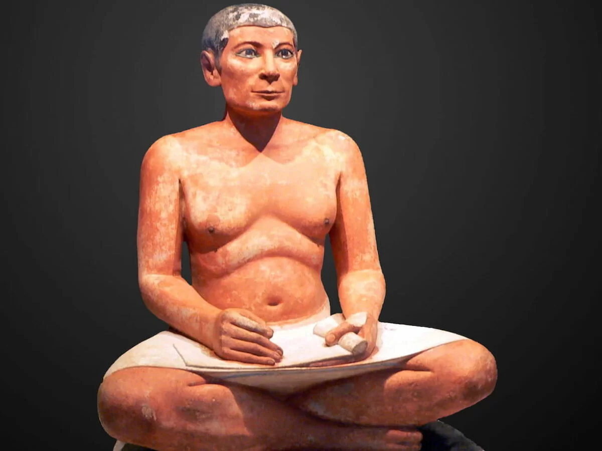
The Satire of the Trades, the text used for centuries by children in Ancient Egypt to learn to read
For centuries, children in Ancient Egypt learned to read using a text known as The Satire of the Trades, a document dating back to around 2400 BCE. This educational text…
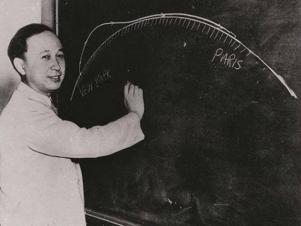
Qian Xuesen, the Scientist Expelled from the United States Who Brought China Into the Space Race
On October 31, 2009, an elderly man, nearly a century old, passed away in Beijing. His name was Qian Xuesen, and in China, he is considered a national hero for…
Two Wines Dominated the Market in Late Antiquity in the Mediterranean: Gaza and Cilician
A recent study has brought to light interesting details about the distribution and consumption patterns of two of the most important wines in the eastern Mediterranean during Late Antiquity. These…
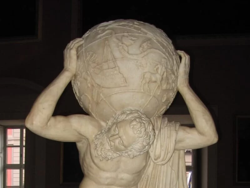
Farnese Atlas, the First Known Representation of the Celestial Sphere
Atlas was one of the Titans in Greek mythology, son of Iapetus and the Oceanid Clymene, and brother of Prometheus. After the war against the Olympian gods, Zeus condemned him…

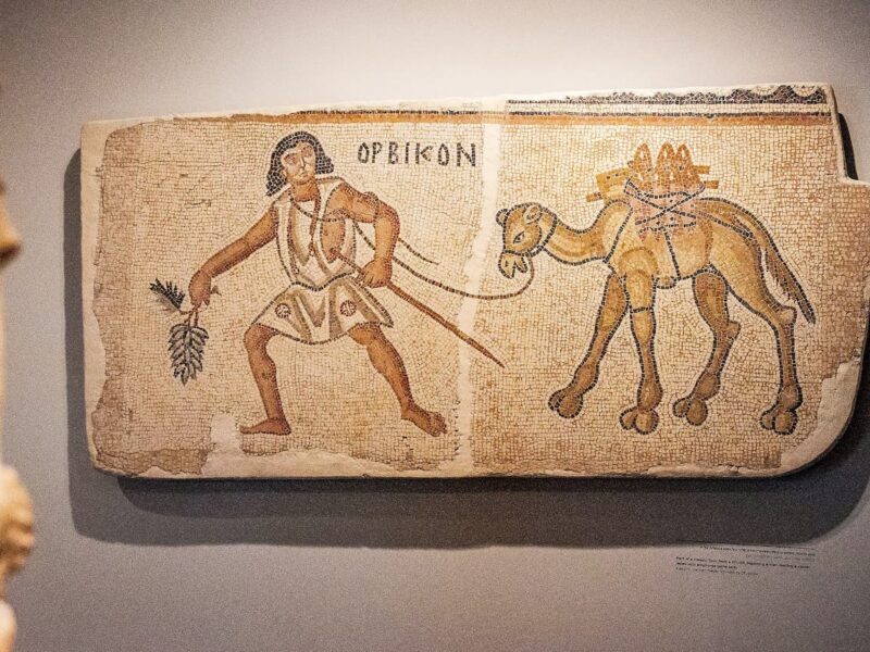
Orsippus of Megara, the First Athlete to Compete Naked in the Olympic Games
A quick glance at any artwork from Ancient Greece gives an idea of the almost religious importance of nudity, and if we interpret the images literally, how widespread its practice…
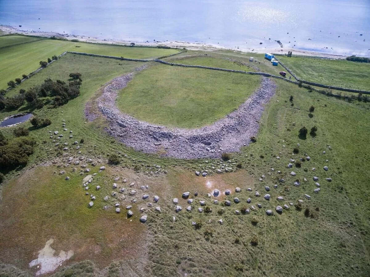
Sandby Borg, the Place where Archaeologists Found a Chilling Iron Age Scene Frozen in Time
The isolated island of Öland, off the southeastern coast of Sweden, holds within its windswept landscape the eroded remains of several fornborgs, circular stone fortifications built during the Iron Age.…

The Wheel Was Invented by Neolithic Miners Who Extracted Copper in the Carpathians 6,000 Years Ago
A recent study published by a multidisciplinary team of researchers aims to solve one of humanity’s oldest mysteries: the origin of the wheel. This invention, which revolutionized human development by…
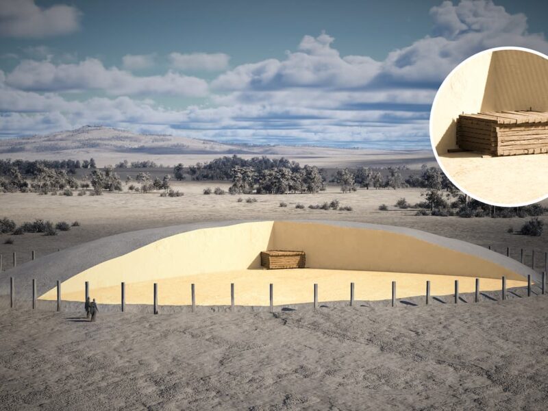
Spectacular Celtic Burial Chamber from the 6th Century BC Discovered in the Center of a 65-Meter-Diameter Burial Mound in Germany
In a remarkable archaeological discovery in the Danube Plain, near Riedlingen, Baden-Württemberg (Germany), an early Celtic burial chamber has come to light. This find is located at the center of…
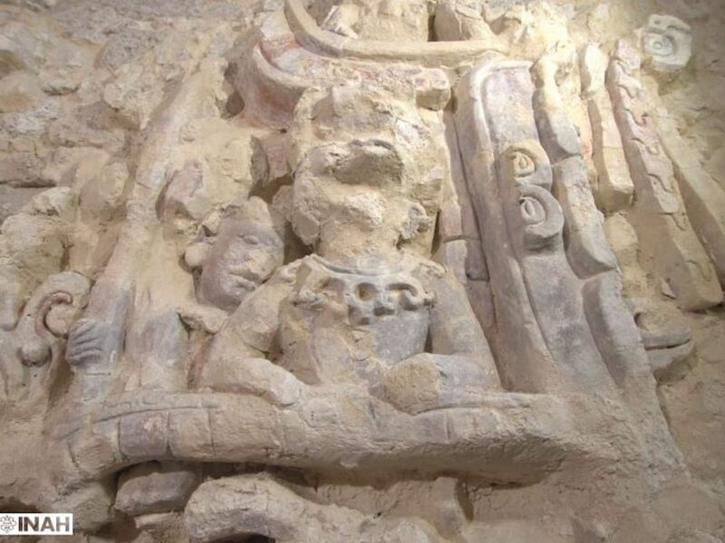
Reliefs with Figures of Guardians, Celestial Ancestors, and Mythical Animals of the Kaanu’l Mayan Dynasty Found in Mexico
The recent archaeological discovery in the Dzibanché Archaeological Zone, Quintana Roo (Mexico), has provided new insights into the grandeur of the Kaanu’l dynasty, one of the most influential in the…
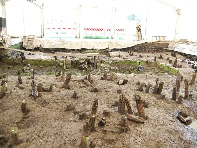
Lucone di Polpenazze, the Bronze Age pile-dwelling settlement that was preserved because a fire caused it to collapse into the lake
Located in the Lombardy region, near the impressive Lake Garda, the archaeological site of Lucone di Polpenazze is a living testament to Prehistory in northern Italy. This place, a large…
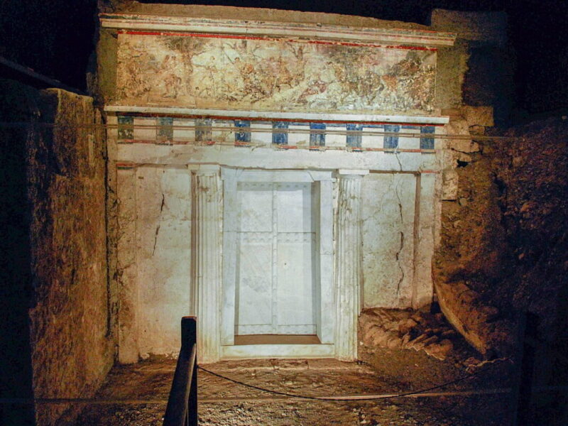
Sacred tunic of Alexander the Great identified in one of the Macedonian tombs at Vergina in Greece
A recent discovery in Tomb II at Vergina, Macedonia, Greece, has revealed what appears to be the sacred “chiton” or tunic of Alexander the Great, a finding that could change…
A House from 8,000 Years Ago Found in Serbia Belonged to the First Sedentary Farmers of Europe
Did the first agricultural societies in Europe live nomadically, or were they (seasonally) sedentary? How did sedentarism spread between Anatolia and Europe, and how did the first sedentary people influence…
Something went wrong. Please refresh the page and/or try again.